TL;DR

Turn quiet afternoons into listening time
- Thousands of audiobooks, podcasts and originals
- Listen on your phone, tablet or Echo — also offline
- Cancel anytime
Eric Gilbertson and his team are conducting precise GPS measurements of Mount Rainier, suggesting the mountain’s height may be different from the official 14,410 feet. This effort aims to update the mountain’s official elevation with new data.
Eric Gilbertson, an engineer and peakbagger, is leading a team to measure Mount Rainier’s height with advanced GPS technology, disputing the long-held official elevation of 14,410 feet.
Gilbertson, who has previously measured Rainier’s height, is now using improved equipment and multiple GPS stations to determine whether the mountain’s elevation has changed. The team is conducting simultaneous, two-hour satellite readings from various points around the mountain, a process that is currently underway.
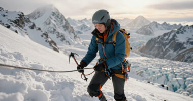
Previous measurements, including those from 1988 and 1999, indicated a height of approximately 14,411 feet, but Gilbertson’s current efforts aim for greater accuracy to potentially update this figure. The process involves a demanding ascent, with the team climbing from the parking lot to the summit in a single push, carrying heavy equipment, including GNSS units and ground-penetrating radar.
Why It Matters
This measurement matters because it could lead to an official update of Mount Rainier’s height, which has remained unchanged for decades despite natural and geological changes. An accurate measurement impacts geological research, mapping, and safety considerations related to the mountain’s stability and glacier coverage.
Additionally, challenging the long-standing figure raises questions about the accuracy of previous surveys and demonstrates advances in geospatial technology. It also highlights the ongoing scientific interest in Earth’s changing landscapes.
As an affiliate, we earn on qualifying purchases.
Background
Mount Rainier has been considered 14,410 feet tall since 1956, with earlier measurements from 1988 and 1999 suggesting a similar height. Historically, mountain elevations have been based on manual surveys, which can be imprecise. Gilbertson’s efforts are part of a broader scientific movement to refine geospatial data using modern GPS technology, often producing different results than older methods.
Previous efforts to measure Rainier’s height have not used the same level of precision or the same methodology as Gilbertson’s current campaign, which aims to set a new standard for accuracy.
“We are using the latest GPS technology to determine the true height of Mount Rainier, and the results could challenge what we’ve long accepted as fact.”
— Eric Gilbertson
“This effort shows how much more precise our tools have become, and how much we still have to learn about our mountains.”
— Branden Joy
As an affiliate, we earn on qualifying purchases.
What Remains Unclear
It is not yet clear whether Gilbertson’s measurements will definitively result in a change to the mountain’s official height. The data collection is still in progress, and analysis will take additional time. There remains some uncertainty about how the new measurements will compare to past data, and whether natural factors like glacier retreat or geological shifts have altered the mountain’s elevation significantly.
ground-penetrating radar for geology
As an affiliate, we earn on qualifying purchases.
As an affiliate, we earn on qualifying purchases.
What’s Next
Once the measurements are complete, Gilbertson and his team will analyze the data and compare it with existing measurements. The results are expected to be published in the coming months, potentially leading to an official update of Mount Rainier’s height. Further verification by geospatial authorities may follow before any change is officially recognized.
As an affiliate, we earn on qualifying purchases.
Key Questions
Why is it important to measure Mount Rainier’s height again?
Accurate mountain measurements are vital for geological research, mapping, and safety planning. Updating Rainier’s height can also improve understanding of geological changes over time.
How does Gilbertson’s method differ from previous measurements?
He is using advanced GPS technology with simultaneous readings from multiple points, providing higher precision than manual or earlier satellite-based surveys.
Could Mount Rainier’s height have changed significantly?
Natural factors like glacier retreat, volcanic activity, and geological shifts could affect the mountain’s elevation, but it remains to be seen whether these changes are large enough to alter the official height.
When will the new measurement results be available?
The data analysis is ongoing, and results are expected within the next few months, with potential updates to official records following verification.
Halloween Picks
halloween
As an affiliate, we earn on qualifying purchases.